


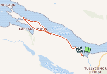
KILLARY HARBOUR

jeanmarcMasson
User GUIDE

Length
12.6 km

Max alt
133 m

Uphill gradient
233 m
Km-Effort
15.7 km

Min alt
1 m

Downhill gradient
236 m
Boucle
Yes
Creation date :
2024-05-23 07:08:36.011
Updated on :
2024-05-23 07:10:13.282
3h34
Difficulty : Difficult

FREE GPS app for hiking
 SityTrail
IGN / Geographical institutes
SityTrail Plus
The world is yours!
About
Trail Walking of 12.6 km to be discovered at Unknown, County Galway, Conamara Municipal District. This trail is proposed by jeanmarcMasson.
Positioning
Country:
Ireland
Region :
Unknown
Department/Province :
County Galway
Municipality :
Conamara Municipal District
Location:
Cushkillary Electoral Division
Start:(Dec)
Start:(UTM)
447684 ; 5938639 (29U) N.
Comments